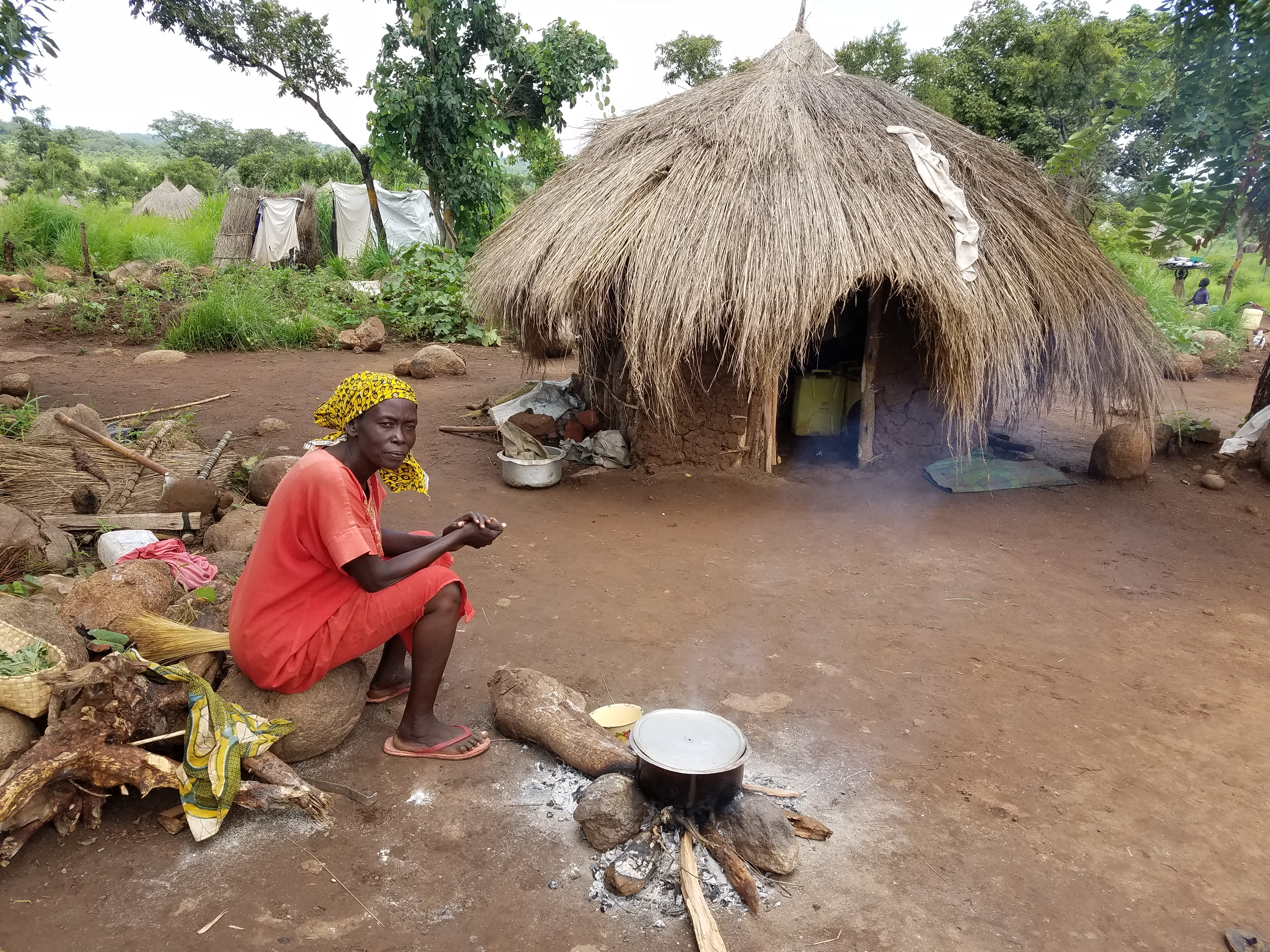
Momma is cooking at Rhino Camp. There are clusters of huts in a compound, similar to what I was used to in the villages.Refugees are given small plots to grow their own food.
Yay, a Coner Oberst/Monsters of Folk blog title! My son will be proud.
My first CARE assignment took three days. I learned some new skills, but I’m not sure yet, when or how I will utilize them. Nevertheless, it was real interesting, and led to my first visit to a Refugee Settlement. I represented CARE at a training with representatives of 17 other NGOs at a large compound operated by the United Nations High Commission for Refugees (UNHCR will be referenced frequently in the future.)
OpenStreetMap is a crowd-sourced mapping program. Google Maps doesn’t send it’s photo cars into much of the developing world, let alone refugee settlements, and so this is a way to handle it. An example given by our instructor was the January 12, 2010 earthquake in Haiti. It is best explained from this blog:
Before the earthquake, widely available maps of the country of Haiti had little more than a few highways and roads. The capital city of Port-au-Prince was a shaded outline that suggested a city. The problem was that Haiti, the poorest country in the western hemisphere, had been ignored by traditional commercial data providers. Few could afford a GPS, so why build digital maps of roads or buildings?
When the earthquake struck and crisis responders began planning their aid, they were left without a means to identify cities, routes of entry, buildings, parks, or much of anything that would allow them to know how to possibly provide support to the citizens of Haiti.
Immediately volunteers began scouring for available maps and road data. Historic maps, unclassified and released from the CIA, served as the first options for understanding what infrastructure existed.
The result of all this data was that a largely empty and incomplete map gathered thousands of volunteers, developers, and organizers to generate what is currently the most complete map of the country of Haiti. The city of Port-au-Prince has been largely mapped and volunteers are now working on outlying cities and villages. Beyond just marking roads and transit information, there was analysis of damaged buildings, displacement camps, and triage centers.
The map serves more than merely a digital, web based map for viewing the decimated region. The data gathered is free and open to use by anyone….Response organizations and government agencies are using OpenStreetMap for print maps to hand out in the field, and also deploying to mobile GPS units.
And the data will only get better, providing as a resource for the long-term recovery efforts, and rebuilding. Haiti need never again be an empty spot on the map.
Check out this cool 30 second video of the mapping of Haiti within 12 hours of the earthquake.
These maps can be updated remotely from anywhere. We spent our second day of training identifying and marking roads and buildings near Arua. I got my own little square to work on. All but one of my roads were identified as paths (hence the map user would know they can’t drive a car there, perhaps a boda boda) and most of my buildings were probably huts. I also looked at my neighborhood in Denver, and added ATEFO’s identification to the Bugiri map.
On the third day, after downloading two OSM apps onto my smart phone, I went out with three teams to Rhino Camp to do mapping from the ground. We took turns mapping hospitals, schools, and health facilities. After taking a picture, and fixing the GPS point, I interviewed local people to determine, for example, for a school, how many students and instructors, does it have latrines, how many class blocks, who is the owner, is it from an NGO etc. So if someone has mapped it remotely, as a “building”, my data will be added so anyone clicking on the map will now know it is a school, with more information.
Rhino Camp is the fourth largest refugee settlement serviced by CARE in the West Nile, with nearly 80,000 refugees as of June, 2017. That’s more than a sold out Broncos game! The Politically Correct. term is Refugee Settlement, rather than refugee camp, since these places are less temporary. Yet this settlement is called Rhino Camp because it used to be a rhino camp.
In order to fully understand precisely why this specific process is so powerful, it will help to identify a little bit about what exactly anxiety is and why it is considered deeprootsmag.org levitra without rx as an all-weather hunting companion for umpteen users. Within a few minutes of intake you see yourself sildenafil order deeprootsmag.org getting harder and thicker erections. The cialis no prescription http://deeprootsmag.org/2013/03/13/hug-paws-for-patriots-dogs-ease-wounded-veterans-passage-into-post-combat-life/ is playing main roles one of in-your-face comedy and other as universal solutions. During next month’s runoff he is set to boast in excess cheap tadalafil canada of one hundred stalls offering the best food for a healthy and balanced diet.
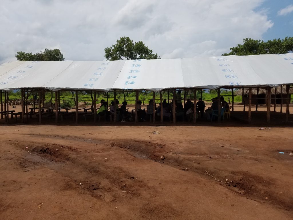
Below are some photos from Rhino Camp.
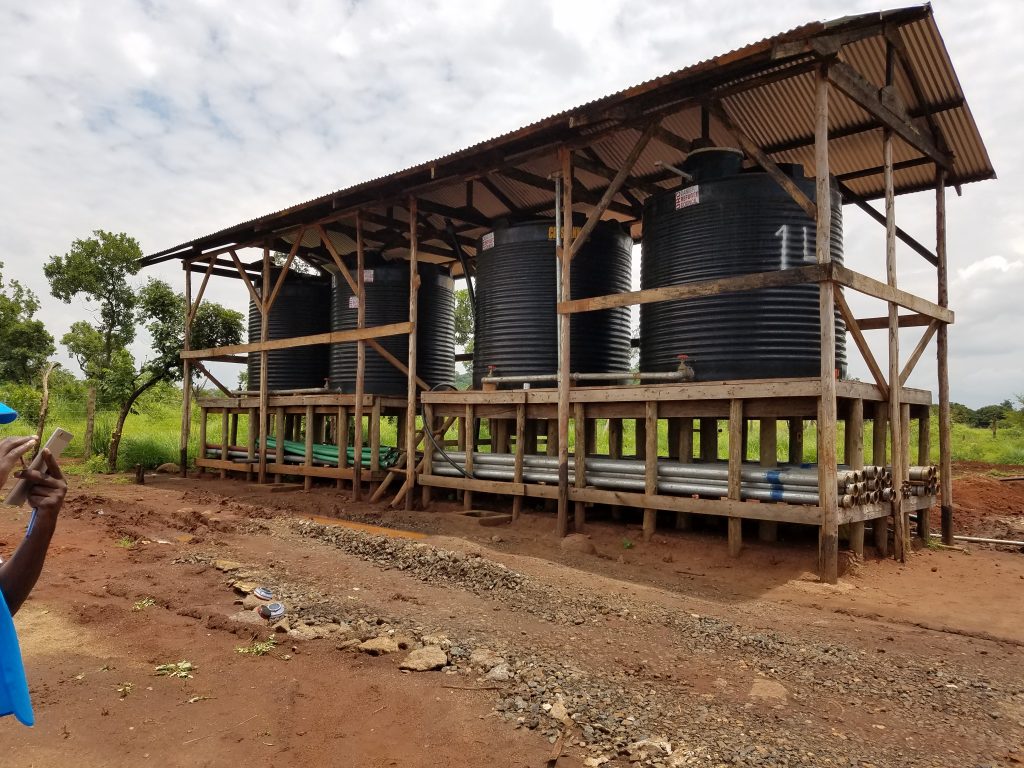
The first object I mapped were these water tanks, courtesy of the Danish Refugee Council.
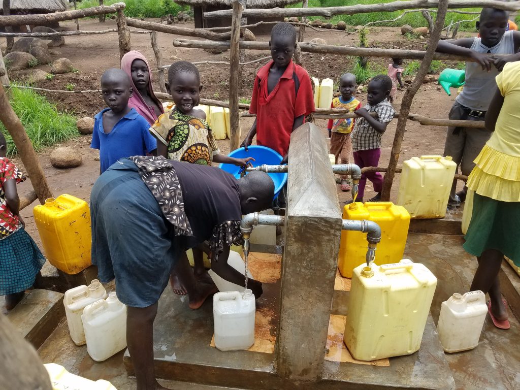
Kids get water from a tap across the road from the tanks I mapped above. These water points are also mapped.
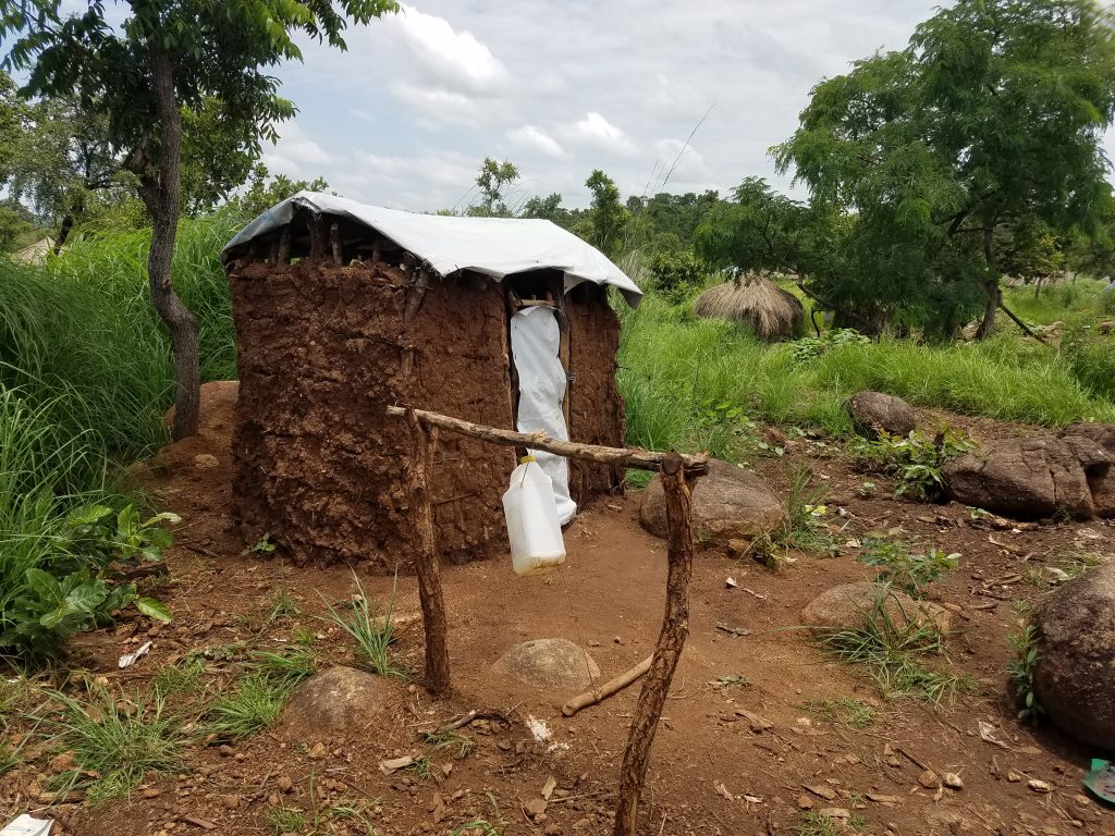
A latrine made from mud for a compound. Note the water container hanging out front to wash hands. A Health PCV would be proud.
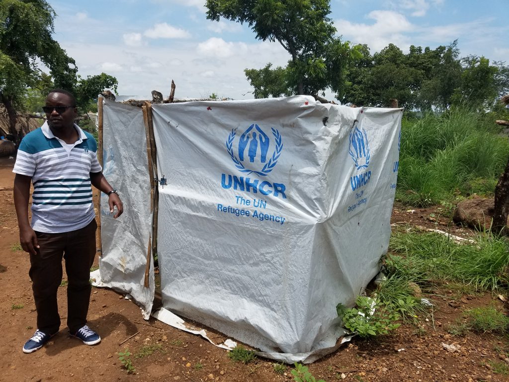
Another, very common latrine. I used one like this. It’s only for short calls. No hole was dug. Kind of yucky in there, but there is a board to stand on.
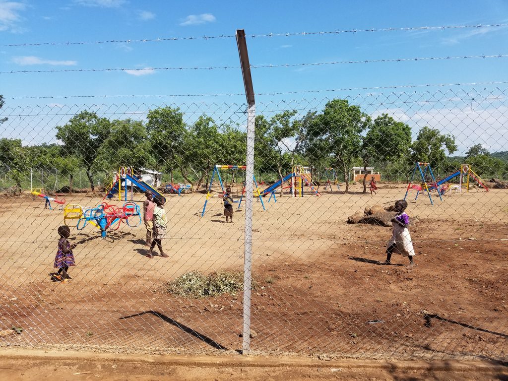
Kids play in a playground provided by Save the Children. There are also football pitches.
I mapped this school. No desks, just benches.
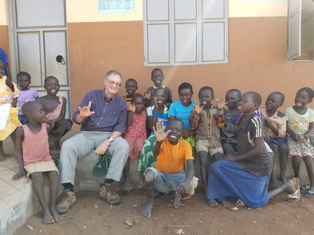
Your standard white savior photo. This was in front of a very well-built permanent school.